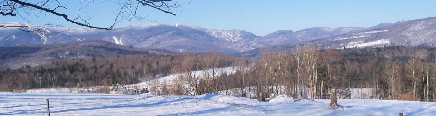
Watershed
Central Vermont Regional Planning Commission’s regional boundary matches perfectly to the upper portion of the Winooski River Basin. It’s the Winooski River and its many tributaries that CVRPC has been involved with assessment and planning. CVRPC assists the Vermont Department of Environmental Conservation in Tactical Basin Planning including the implementation of strategies within those plans. One key strategy that the CVRPC is heavily involved in is municipal stormwater master planning and assisting municipalities to design and construct stormwater treatment projects identified as priorities in those plans. CVRPC has also been involved in stream geomorphic assessments across our Region utilizing the Vermont Agency of Natural Resources’ River Management Program Fluvial Geomorphic and Corridor Planning guidelines. Our partners for this work include the Friends of the Winooski River, Friends of the Mad River, Winooski Natural Resource Conservation District, the Watershed Planning Program, the River Management Program, and the municipalities of Central Vermont.
WINOOSKI BASIN WATER QUALITY COUNCIL
The Basin Water Quality Council (BWQC) establishes policy and makes decisions for the Clean Water Service Provider (CWSP) regarding the most significant water quality impairments that exist in the basin and prioritizing the projects that will address those impairments based on the basin plan.
Council Members: Peter Danforth, Natural Resources Conservation District; Remy Crettol, Natural Resources Conservation District; Steve Libbey, Watershed Protection Organization; Michele Braun, Friends of the Winooski River; Corrie Miller, Watershed Protection Organization; Darlene Palola, Chittenden County Regional Planning Commission; Royal DeLegge, Central Vermont Regional Planning Commission; Annie Costandi, Town of Essex; Alice Peal, Town of Waitsfield – Council Alternates: Russ Barrett, Natural Resources Conservation District; Shawn White, Watershed Protection Organization; Brian Shupe, Watershed Protection Organization; Garret Mott, Chittenden County Regional Planning Commission; Rich Turner, Central Vermont Regional Planning Commission; Sarah McShane, Town of Stowe
CLEAN WATER ADVISORY COMMITTEE
The Clean Water Advisory Committee (CWAC) oversees CVRPC’s water quality planning program in accordance with CVRPC plans, policies, and procedures; acts as a liaison between local communities and the Vermont Agency of Natural Resources; and provides local and regional input regarding water quality issues important to the region. Click on the link above for more details about this Committee and the work it does.
WETLAND SCREENING TOOL
The Vermont Department of Environmental Conservation (DEC) has released a new wetland screening tool to help landowners determine if their property contains wetlands and if they may need a wetland permit by simply entering an address. A landowner can enter their address and the tool will notify you if there is likely any wetlands or hydric soils (often an indication of wetlands) on your property and contact information for the wetland scientist at the DEC.
TACTICAL BASIN PLANS
The Vermont Department of Environmental Conservation (DEC) has a basin planning process where 15 basins or watersheds have been identified throughout the state. The Watershed Planning Program updates Tactical Basin Plans (TBP) for each basin every 5 years and the CVRPC is a key partner in the update process. For more information on the TBP process click on this link.
See a recent press release outlining our efforts with our partners: CVRPC Tactical Basin Planning Press Release
CVRPC and the DEC thanks everyone for their input, feedback, comments, and participation in the TBP review process and public meeting attendance. These plans are a wonderful example of collaborative partnerships and science-based protection and restoration prioritization as Vermonters work to meet the goals set forth in the plan and the state and federal Clean Water Acts. Keep up the good work!
Winooski Tactical Basin Plan
Please also enjoy this interactive StoryMap about the Basin Plan.
Since the plan was finalized the CVRPC has been working with partners and municipalities to implement strategies including stormwater improvement. In the fall of 2021 the CVRPC, watershed groups, WNRCD, and the DEC will be working together to update the plan for a vision of the Winooski River and its tributaries over the next five years. STAY TUNED FOR BASIN PLANNING UPDATE INFO ON THE WINOOSKI!
White River Tactical Basin Plan
Lamoille River Tactical Basin Plan – 2021 Update!
The Lamoille Basin Plan is currently being updated! With one of its municipalities in the Lamoille River Basin, Woodbury, the CVRPC is embarking on another Basin Planning effort with the Department of Environmental Conservation to update the Lamoille Tactical Basin Plan. Click here for more information from the Watershed Planning Program at DEC on the Lamoille TBP update and/or view this Story Map.
See the latest press release here for the Lamoille Tactical Basin Planning effort: Lamoille Tactical Basin Plan Press Release
Stormwater Mitigation
Stormwater Master Plans
Barre City Barre Town and Plainfield
Final Designs
The Health Center in Plainfield, Vermont
A collaborative effort among the CVRPC, the Town of Plainfield, the Health Center, and landowners culminated in a stormwater final design to slow down water runoff and restore a gully down slope of the Heath Center which has been eroding for years. This design was funded by the Vermont Department of Environmental Conservation and completed by Milone and MacBroom, Inc.
Details of The Health Center Final Design are outlined in this Final Report.
Town of Berlin
Through funding from the Lake Champlain Basin Program (LCBP) and the New England Interstate Water Pollution Control Commission (NEIWPCC), stormwater final designs were completed for three sites in the Town of Berlin: Berlin Elementary School, Berlin Fire Station, and the Chimney Sweep Fireplace Shop. Details of the project are outlined in the Final Report.
Photos from the sites are available through these links: Berlin Elementary School, Chimney Sweep, and Fire Station.
All data from the project may be downloaded via this link.
Town of Woodbury
Woodbury has been very active at forwarding stormwater projects from concept to final design that originated in the Kingsbury Branch Stormwater Master Plan. In 2019-2020, four projects were funded through two different programs from the Clean Water Initiative Program (CWIP): Ecosystem Restoration Program and the Design Implementation Grant Program).
Stormwater Treatment Implementation
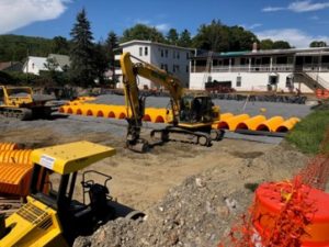
Berlin Town Office and Garage Stormwater Treatment
Through funding from the Vermont Department of Environmental Conservation, a gravel wetland concept design for the Berlin Town Office from Berlin’s Stormwater Master Plan was forwarded to final design and is being constructed this spring. The Town Office is one of the Municipal owned properties that is subject to the Vermont 3-acre General Stormwater Permit. CVRPC assisted the Town by bringing this project from concept to implementation through the funding acquisition, project management and helping the Town to comply with the 3-acre stormwater rule. The final design report completed by Dubois & King is available here.
Town of Northfield
In 2019 using grant funding from the Vermont Department of Environmental Conservation, the CVRPC implemented a subsurface stormwater infiltration project in Northfield on Water Street in a Town owned lot that became a buy-out site following devastating flooding in 2011. The Town continued it’s effort in flood resiliency from the buyout to reduce stormwater and pollutants entering the Dog River by treating stormwater at the undeveloped site and was able to maintain it as green space.
River Corridor Plans
Waterbury River Corridor Plan
Corridor Plan Executive Summary
River Corridor Plan no Appendix – PDF 33 MB
Corridor Plan Appendix – PDF 16 MB
Great Brook Corridor Plan and Other Plainfield Studies
Plainfield, VT Great Brook River Corridor Plan – PDF 62 MB
Plainfield, VT Great Brook Landslide Report – PDF 17 MB